Your shopping cart is empty!
0


$0.00
0
$0.00
The Future of Educational Robotics
Discover how these new technologies work together to expand the possibilities of competitive robotics.
VEX GPS Sensor
Install the Game Positioning System (GPS) on your robot
Apply the VEX Field Code to the field interior
Track X, Y Position and Heading on the field

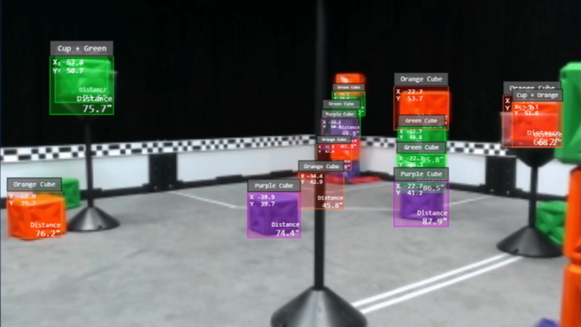
VEX AI Vision System
Explore Artificial Intelligence
Detect hundreds of objects simultaneously
Determine object type, location, and distance
Experience a LIVE view of augmented reality
VEX LINK Communications
Activate VEX LINK Communications
Communicate from Robot-to-Robot
Send messages and data between bots
Coordinate robot actions

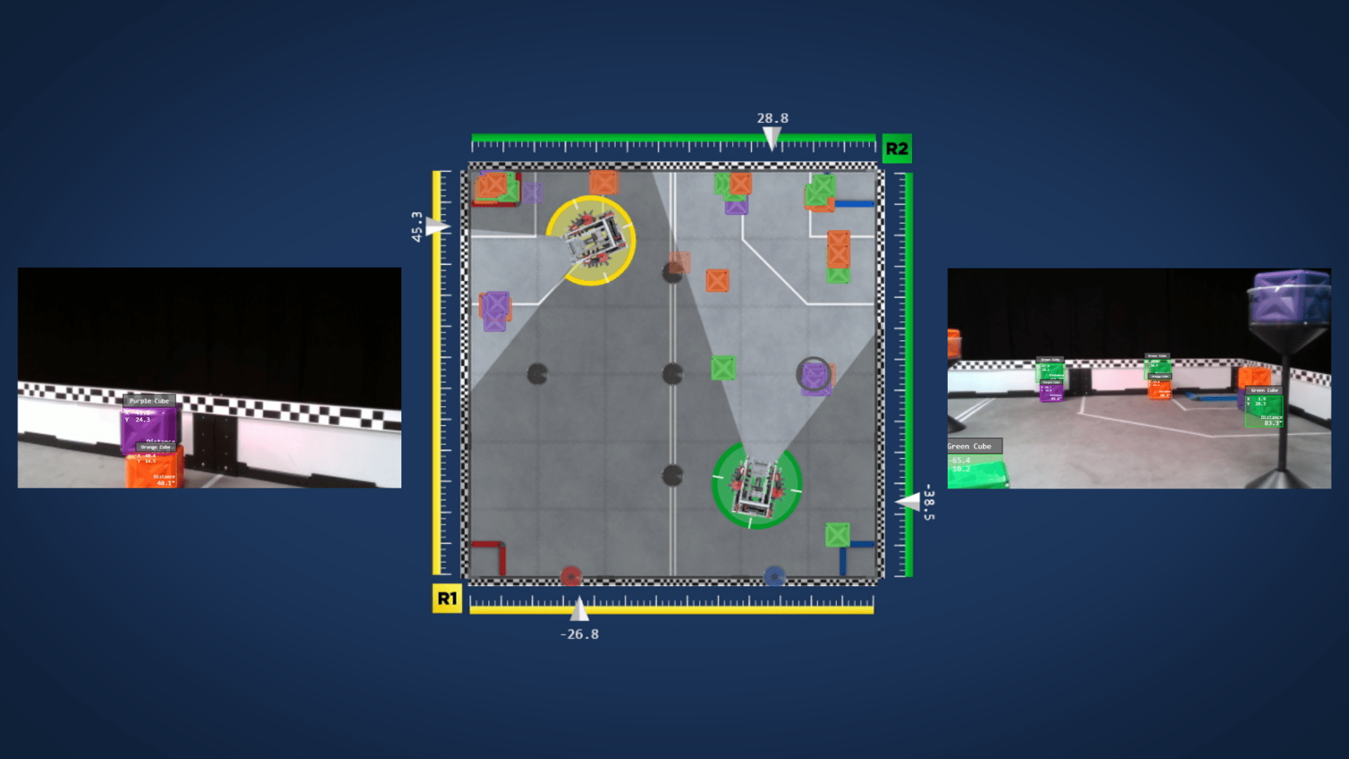
Sensor Fusion Map
Locate robots, objects, and goal on the map
Share information from robot to robot
Watch it all in real time via WiFi
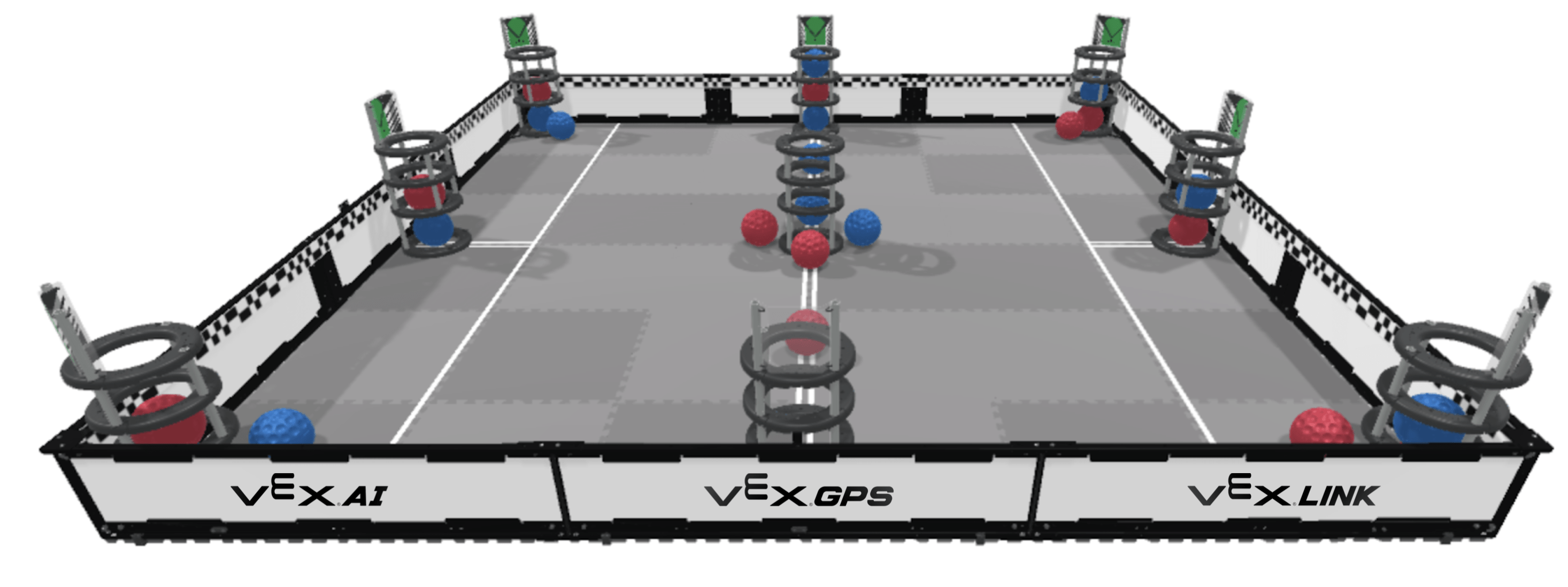
VEX AI Competition
Presented by the REC Foundation

Overview
VEX AI, VEX GPS, and VEX LINK, and the resulting Sensor Fusion create an opportunity for students to take their autonomous robots a level up! The VEX AI Competition pushes the boundaries of robotics competitions. The game is separate from the VRC and VEX U competitions.
Here's how it works
Each team brings two robots that they design and build to work as a team. Teams can 3D print and machine parts. Teams can use custom electronics, and there are no motor quantity limits. This game will be open to High School students and College students alike. Game registration will include the hardware needed for that year’s competition to run VEX AI, VEX GPS, VEX LINK, and Sensor Fusion Map.
More information to follow!
Leave a Reply
Your email address cannot be published. Required fields are marked*


No comments